Best Photogrammetric Software
6-7 minutes approx
In the rapidly evolving landscape of decision-making, PIX4D stands as a beacon of
transformation in the realm of 3D mapping and modeling. With its substantial impact
spanning a multitude of industries, PIX4D is fundamentally altering the way professionals
approach critical decisions. From the realms of surveying and construction to agriculture,
telecom, public safety, mining, and inspection, PIX4D is bestowing professionals with the
transformative tools to reimagine their respective fields.
Breaking Boundaries Across Diverse Sectors
PIX4D's remarkable influence permeates across a diverse spectrum of industries, redefining their operational landscapes:
Surveying: In the field of surveying, PIX4D is rewriting the rules by expeditiously generating
detailed 3D maps and models. Even in areas plagued by limited data availability, PIX4D
empowers surveyors to extract intricate details with an unprecedented level of precision.
Construction: The construction industry is experiencing a paradigm shift courtesy of
PIX4D's comprehensive platform, which seamlessly integrates UAV mapping, progress
tracking, and site documentation. The advanced insights offered by PIX4D elevate project
management efficiency to an entirely new echelon.
Agriculture: The agricultural sector is undergoing a digital transformation powered by
PIX4D, which brings about a revolution through field mapping and aerial crop analysis.
Farmers, armed with data-driven insights, are now steering their decisions towards
maximizing crop yields and ensuring prosperous harvests.
Telecom: Within the realm of telecom, PIX4Dscan and PIX4Dinspect have introduced
automation to industrial inspections. These tailor-made solutions are paving the way for
seamless scalability within the sector.
Emergency Response: In situations demanding rapid response, PIX4D's swift mapping
software emerges as a lifeline for first responders. It empowers them with the capability to
conduct quick and precise assessments during emergencies, facilitating effective decision-
making.
Mining: The mining industry is undergoing a technological transformation, thanks to PIX4D's
cutting-edge technology that crafts ultra-precise 3D models and orthomosaics of mining
sites. This enhanced data supports resource management strategies with unparalleled
accuracy.
Inspection: From infrastructure to utilities, PIX4D is redefining the concept of inspections.
Its high-quality data ensures thorough checks, thereby enhancing safety and efficiency
across industries.
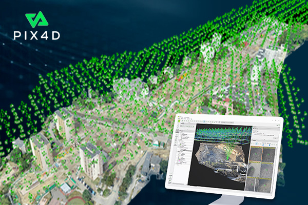
Seamless Integration and Bridging Gaps
PIX4D's strength lies in its seamless integration of UAV mapping and photogrammetry
software tools across a multitude of platforms. These platforms encompass flight
applications, desktop interfaces, and cloud systems. The seamless adaptability of PIX4D's
tools streamlines the planning, data capture, and processing processes with remarkable
accuracy, thereby enhancing the efficiency of operations.
Bridging Photogrammetry and CAD: The Power of Transformation
PIX4D's groundbreaking contribution extends to bridging the chasm between the realms of
photogrammetry and Computer-Aided Design (CAD). This innovative approach transforms
UAV-captured images into meticulously detailed 3D maps, orthomosaics, elevation models,
and immersive reconstructions. This transformation empowers professionals across
industries to make informed decisions imbued with unparalleled confidence.
Tailoring Applications to Industry Needs
PIX4D extends its prowess to cater to the unique requirements of various industries:
Telecom: PIX4Dscan and PIX4Dinspect are revolutionizing inspections in the telecom
industry by offering automated solutions tailored to its distinct needs.
Agriculture: By offering field mapping and aerial crop analysis, PIX4D is empowering the
agricultural sector for optimal crop management, thereby contributing to increased efficiency
and yield.
Emergency Response: PIX4D's rapid mapping software serves as a critical tool for first
responders, enabling swift and accurate assessments during emergency situations.
Construction: The comprehensive online platform offered by PIX4D supports construction projects by integrating UAV mapping, progress tracking, and site documentation, ultimately enhancing project management efficiency.
Parrot Sequoia + & Pix4D: Enhancing Workflow and Accuracy
The collaboration between Parrot Sequoia+ and Pix4D is revolutionizing data capture by
providing absolute reflectance measurements without the need for reflectance targets.
Powered by Pix4D's radiometric processing pipeline, this collaboration ensures consistent
data evaluation and eliminates the requirement for reflectance targets. The automatic
radiometric calibration facilitated by Pix4D software, such as Pix4Dfields and Pix4Dmapper,
saves operational time and enhances precision in reflectance measurements.
Concluding the Mapping Revolution
PIX4D's photogrammetry software suite marks a monumental leap in mapping, surveying,
and data capture. By harmonizing the capabilities of UAVs, cutting-edge software, and
advanced features, PIX4D is reshaping industries and expanding our understanding of
space and decision-making. As the mapping landscape is poised for boundless
opportunities, it's evident that PIX4D's visionary innovation is at the helm of this
transformation, revolutionizing the way industries operate and revolutionizing our world.
Back to all Blog